Will Tensions over Diaoyu Islands Subside?
 Facebook
 Twitter
 Linkedin
 Google +
Washington must avoid exacerbating this issue by unwisely leaning to the Japanese side and let Japan and China find their way over time to a peaceful resolution of this dispute.
Will tensions between China and Japan over the Diaoyu Islands subside given the change in government in Tokyo? The international legal dispute of many decades must be resolved peacefully through diplomacy. The United States must not exacerbate the situation.
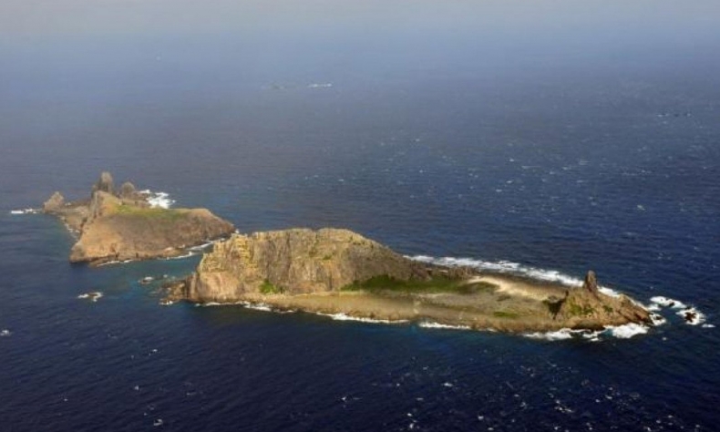
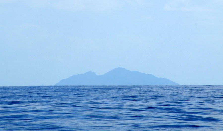
There are eight islets in the Diaoyu chain and they were formed by volcanic action in the Neocene age. They are located in the East China Sea about 120 nautical miles northeast of Taiwan island, 200 nautical miles east of mainland China, and about 200 nautical miles southwest of the city of Naha, Okinawa.
Okinawa is part of the Ryukyu Islands which in times past comprised a kingdom over 36 islands and was a tributary of China for many centuries. The Diaoyu Islands were never part of the Ryukyu Kingdom nor even claimed by it. Japan grabbed the islands during the time of the Sino-Japanese War of 1894-95. In the past, the islands were associated with Fujian and with Taiwan island.
The dispute over the Diaoyu islands involves history and legal interpretations. Simply put, there are two sides to the dispute, China and Japan. It should be noted that the Taiwan authorities has also claimed the islands are Chinese and associated with Taiwan island.
Japan says it “discovered” the islands in 1895 and they were vacant. Advised by Western specialists, Japan invoked Western international law concepts to advance its claim. Under the Western concept of “discovery” of vacant land (terra nullius), Japan asserted this “discovery” made the islands Japanese.
China, on the other hand, argues that the islands have been part of China for many centuries. This is so because of the traditional East Asian order in which the islands can be seen as Chinese from historical records and historic maps and naval charts.
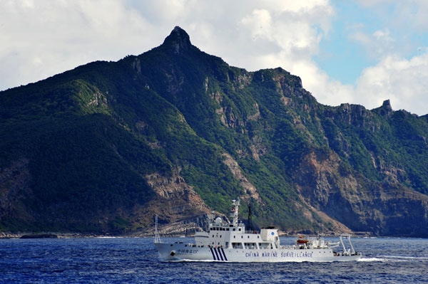
The dispute flared up in recent times since the 1970s, for example in 1970-1972, 1978, 1990, and 1996-1997. So the dispute is longstanding and has its ups and downs. In recent weeks, the Japanese side has increased tensions with statements about defending them militarily, claiming they are part of Japan.
As noted earlier, the situation is one of an international legal dispute. It can be resolved peacefully through diplomacy or adjudication. This requires patience and a long-term approach to give either process a chance. China adopted a pragmatic approach under Deng Xiaoping saying that the matter should be “shelved” and that later generations could deal with it peacefully.
On the other hand, Japan can provoke conflict over the islands and expect the US to be dragged into the situation. The US, in the early 1950s, placed the islands within the perimeter of the Ryukyu Islands for administrative purposes. In 1971, the US Reversion Treaty of Okinawa assigned the islands to the Japanese administration. At this time, the US took no position on the legal dispute and furthermore did not include the islands within the concern of US-Japanese defense arrangements.
Subsequent to the 1970s, Washington changed its position and said that the islands were indeed included in the defense perimeter understood by US-Japanese defense arrangements. This reckless position change eliminated a US free hand over a potential military flash point that might drag the US into armed conflict with China.
So what is the historical situation behind China’s position?
Scholars who have examined the historical situation, including some Japanese scholars, view China’s claim as going back to the 14th century. They say that many centuries of history show that the islands were always regarded as Chinese and thus they cannot fit into Japan’s legal argument that it “discovered” unoccupied islands, terra nullius, in 1895.
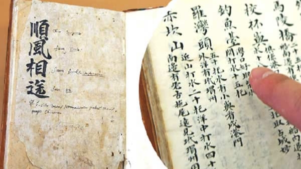
Using historical manuscripts and other documentation, an interesting and relevant record appears. In brief, such documentation shows that the Diaoyu islands in fact represented the boundary line between China and the Ryukyu Kingdom. Specifically, the historic boundary line existed in the high seas between the most northeastern of the Diaoyu islands called Chiwei Yu and Ryukyu’s Kume-jima.
In 1562, the Diaoyu islands were incorporated into China’s coastal defense system by the Ming dynasty. This was to counter the raids of the Japanese pirates, so-called Woko.
Later, during the 18th century, China placed the islands within the defense system of Taiwan island. Chinese naval forces stationed on Taiwan island patrolled the waters.
What about the Ryukyu Kingdom all this time?
The Ryukyu Kingdom became a tributary state of the Ming dynasty in 1372. For the next five hundred years, it offered tribute to China. Confirming this relationship, the Emperor of China sent twenty-four investiture missions to bestow the formal title of “Zhongshan Wang” to a new Ryukyu king. The Chinese imperial officials kept very extensive and detailed records of these missions. They were presented to the Emperor on their return. These official records constitute part of the documentation for the Chinese legal position.
Aside from the formal aspect of the investitures, there are interesting records of the maritime route the officials took to sail to and from the Ryukyu Islands and the port city of Naha. Ships would leave from Fuzhou and sail what was called the “Compass Route” to Naha. They passed by the Diaoyu islands. One record from 1403, specifically identifies these islands along the famous route.
A very interesting part of the story involves the “Black Water Trough”. The color of the sea changed from blue to black over this deep trough in the seabed. It marked the boundary of Fujian waters and it had to be sailed over to arrive eventually in the Ryukyu Islands. This natural boundary is known today as the Okinawa Trough which is a 2,270 meters deep trough. Oceanographers point out that the Okinawa Trough is not the same seabed feature as the Ryukyu Trench which is elsewhere.
This fascinating history shows that both China and the Ryukyu Kingdom considered themselves neighbors with the Black Water Trough as a delimitation of their boundary. The islands were administered during the Ming dynasty as within Fujian province. During the Qing dynasty, Taiwan island was a prefecture of Fujian province.
Interestingly, and to the point, some historic Japanese maps indicate the Diaoyu islands as part of China. Most often referred to is Hayashi Shihei (1738-1793) who was a military scholar-cartographer during the Edo period. In his famous work “Illustrated Survey of Three Countries” (Korea, Ryukyu Kingdom, Ezo/Hokkaido) he portrays the Diaoyu islands as part of the Compass Route and as belonging to China.
Chinese maps also have indicated the Diaoyu islands as part of China. In the nineteenth century, the Imperial Map of Native and Foreign Lands published in Hubei province in 1862 included them as part of China.
Overall, the issue of the Diaoyu islands is a longstanding international legal dispute that diplomats can negotiate peacefully about over time. Many scholarly resources can be applied to the arguments as seen above.

With the new Japanese prime minister from the moderate faction of his party it can be hoped that this issue will be managed correctly and that tensions will be reduced. Washington must avoid exacerbating this issue by unwisely leaning to the Japanese side and let Japan and China find their way over time to a peaceful resolution of this dispute.
The article reflects the author’s opinions, and not necessarily the views of China Focus.